
Map of the Trip 🗺️
30,000km · Anticlockwise · July 2018 – April 2020 · Click any waypoint for details
The Route
- 🟢 Sydney, NSW — Departed July 4, 2018
- ☀️ QLD Coast — Byron Bay → Brisbane → Airlie Beach → Cairns
- ⬆️ Cooktown — Northernmost point, via Cape Tribulation
- 🌊 Gulf Country — Savannah Way through Karumba (Gulf of Carpentaria) — barramundi central
- 🐊 Northern Territory — Kakadu, Darwin, Katherine
- 🏜️ Red Centre — Alice Springs → Uluru → Kings Canyon
- 🌊 Western Australia — Kimberley → Broome → Ningaloo → Perth (Christmas 2018)
- 🧭 Nullarbor Plain — 1,200km of nothing but sky and road
- 🍷 South Australia — Adelaide, Barossa Valley
- ☕ Victoria — Great Ocean Road, Melbourne
- 🔴 Sydney, NSW — Home — 2020
| Total Distance | 30,000 km |
| Duration | ~9 months |
| Direction | Anticlockwise |
| Northernmost point | Cooktown, QLD |
| Vehicle | Winnebago Bondi 2S |
| States & Territories | NSW · QLD · NT · WA · SA · VIC |
| Christmas 2018 | Perth, WA 🎄 |
Live GPS Track 📡
Real GPS positions from our Spotwalla tracker, every dot is a real location recorded during the trip.
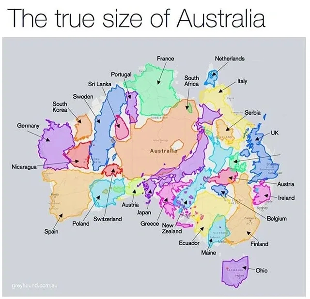
How Big is Australia? 🗺️
People underestimate how vast Australia really is. It’s comparable in size to the contiguous United States. New South Wales alone is more than twice the size of Germany, and we still only scratched the surface. Fly-over country doesn’t quite cover it when the flight alone takes four hours.
30,000km of it, in a van, over 9 months, and we still didn’t see everything. That’s Australia. 🇦🇺